Window-Seat Photos from the Gimpo-Bound Flight: Jeju Airport's West Side Down to Gonae-ri
Window-seat photos along Jeju's northwest coast — from Yeondae-pogu and Maimot in Iho, past Hagwi-hang and Susan-bong, on to Gonae-ri before the turn for Seoul.
I'm not exactly sure when I took these. But judging by the kids' masks, it was somewhere back in the COVID years. I love window seats too. Once I started flying with the kids, though, that pretty much went out the window — unless I'm on a solo work trip.
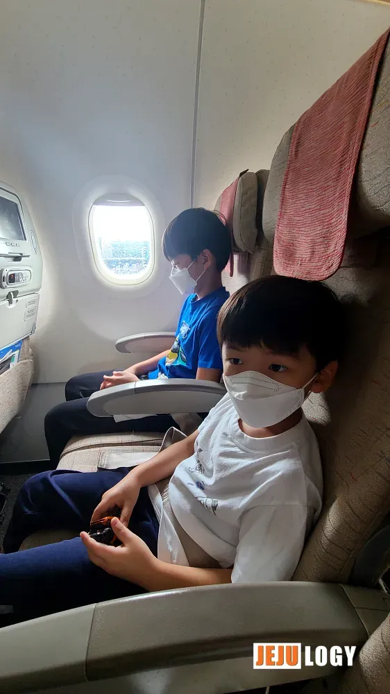
After flying the kids back and forth so many times, neither watching planes at the airport nor staring out the window mid-flight does much for them anymore. (If that's the case, kid, hand the seat over here, please.)
A Flight Along Jeju's Northwest Coast
This flight took off east to west, so we ran along the coastal villages on the western edge of Jeju City and into Aewol. Shooting past the kids through a moving plane meant the framing came out a mess and everything was shaky. And why was the window so smudged? Honestly, it's probably because I never wipe the lens.
Yeondae-pogu, Maimot, and a Place That's Already Gone
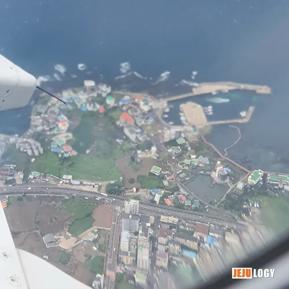
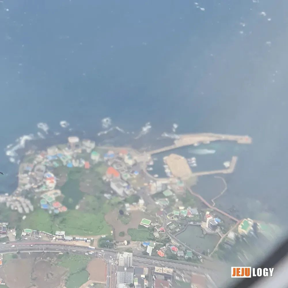
This one's Yeondae-pogu (연대포구) and Maimot (마이못). It's called Yeondae-pogu because of Joboo Yeondae (조부연대), the old beacon-watch tower sitting right next to it — but from up here I can't actually pick out the yeondae itself. The port owes its name entirely to that watchtower. Across Jeju there are a few villages still called Yeon-dwi-maeul (연듸마을), all of them sitting where old defensive yeondae used to stand. The long east-west road in the frame is Iljuseo-ro (일주서로), the western coastal route.
Maimot, just inland from the port, is a coastal wetland — a brackish pond where fresh water and seawater mix. The name supposedly comes from how the shape resembles a horse's ear (mai, 마이 = horse ear). Even looking down from a plane, I'm not really seeing it.
A bit of context for non-Korean readers: In Joseon-era Jeju, yeondae (烟臺) were low coastal smoke-and-fire beacons built to warn against approaching enemy ships. They were a tier lower than the mountain-top bongsu signal towers but more numerous along the shoreline. The fact that village names still carry the yeon- root tells you how thick that defense network once was.
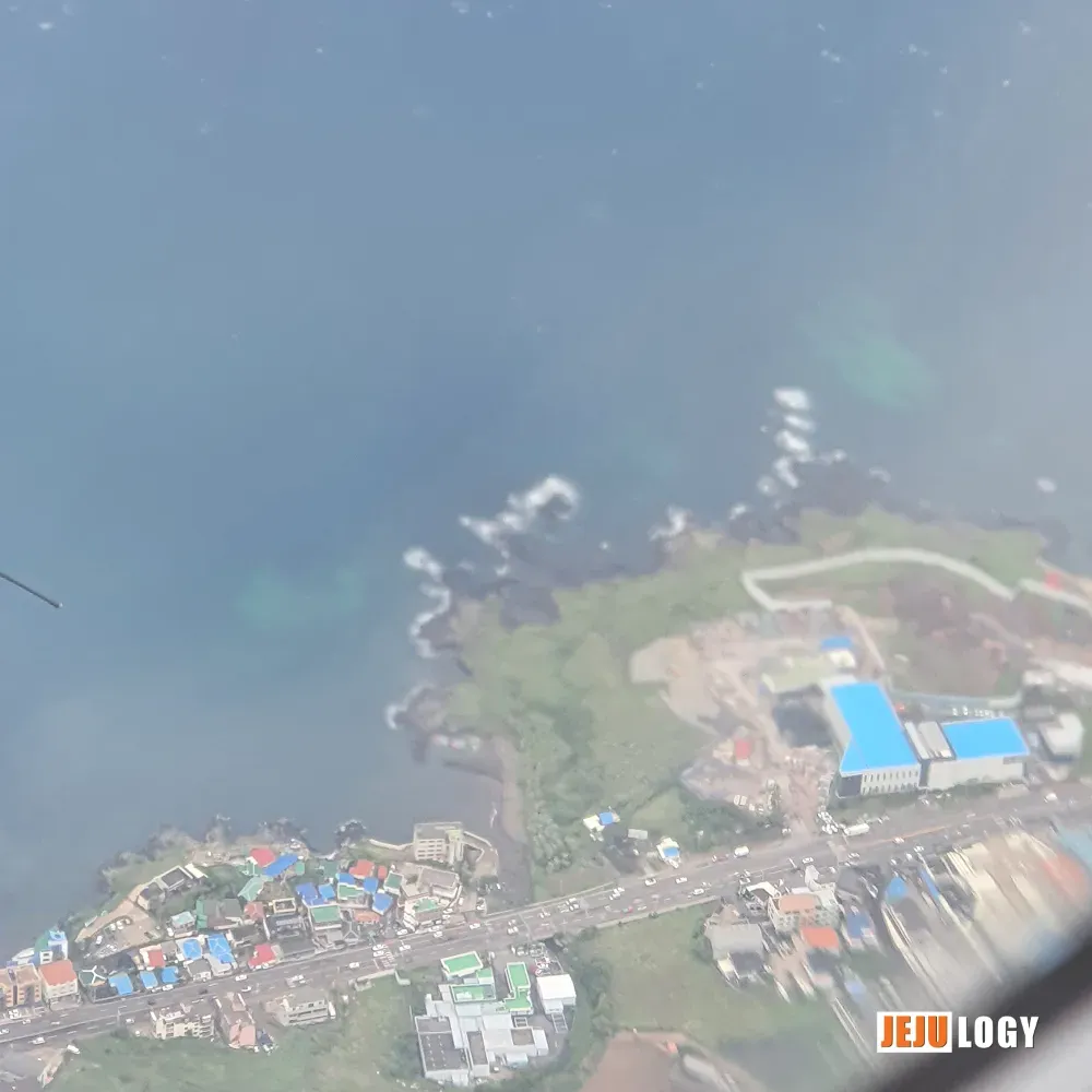
Right behind that blue-roofed CJ building, the empty lot is now filled in by Shilla Stay Plus Iho Tewoo (신라스테이 플러스 이호테우). The Jeju I knew just a few years ago keeps disappearing on me.
Hagwi-ri, Hagwi-hang, and a Stream
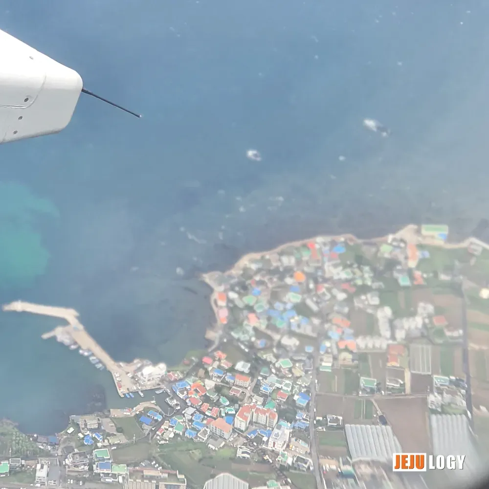
Now we're passing over Hagwi-ri (하귀리). I can pick out Hangpo-pogu (항포포구) and the patchy farm plots east of the houses. How much longer will those plots stay as fields?
Hagwi-hang (하귀항). A fair number of boats moored up. It's a noticeably larger port than the average Jeju village pogu. The simplest way to think of the distinction: hang (항) refers to a larger, more formal harbor; pogu (포구) is the smaller, traditional fishing-village kind. The two get used interchangeably plenty of times, so don't read too much into it.
Note for non-Korean readers: Jeju's coast is dotted with small pogu — natural rocky inlets that local fishing families have used for centuries. A hang, by contrast, is engineered: dredged, walled off with breakwaters, and officially designated. Hagwi1-ri Port was designated as a regional fishing port (지방어항) back in 1999.
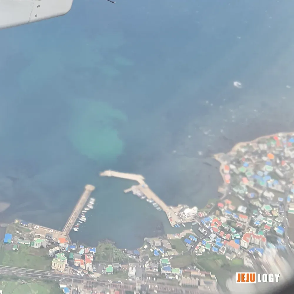
The stream working its way down the photo is Goseong-cheon (고성천), and the small port on the left is Misudong-pogu (미수동포구) — also called Misudong-hang.
And somewhere along this stretch there's a tree-shrouded compound, walled off behind barbed wire, that I've never been able to identify from the ground either. A bit of digging suggests it's the FEBC (극동방송, Far East Broadcasting Company) transmitter site — records show FEBC bought roughly 36,000 pyeong (about 11.9 hectares) of land in Hagwi-ri for its Jeju transmitter. That tracks with what you see on the ground. Doesn't look ordinary, but with no firm info on the day-to-day, I'll leave it alone.
Susan-bong and the Turn at Gonae-ri
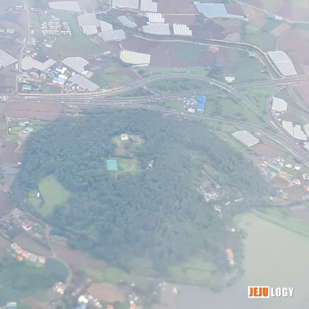
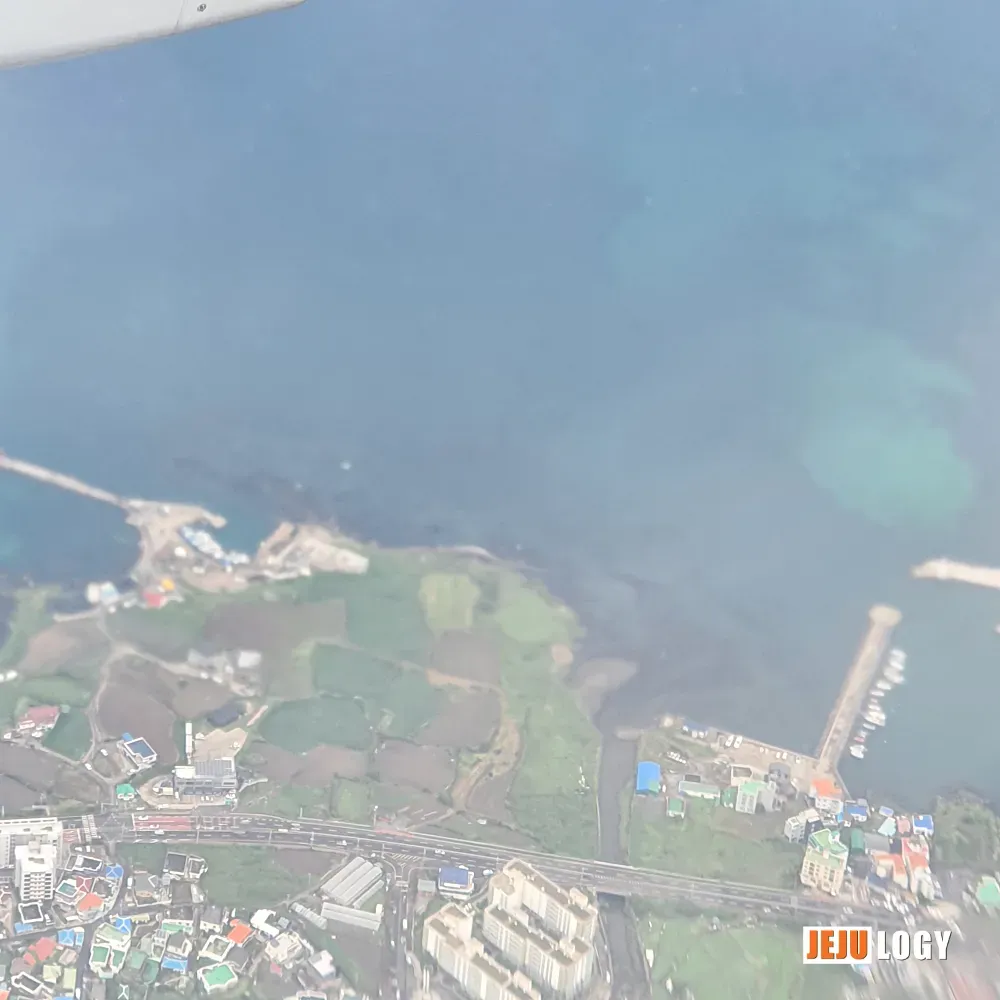
Susan-bong (수산봉, also called Mulme-oreum, 물메오름). A shame the photo turned out so hazy — for a second I thought maybe it wasn't my phone camera but actual fine dust in the air. There's a telecommunications base station and another special facility at the summit. Coming down the eastern slope you pass Daewon-jeongsa (대원정사) and Wonchon-sa (원천사). Step onto Gomsol-gil (곰솔길), the trail loop running between the peak and the reservoir, and the old gnarled black pines (gomsol, 곰솔) are surely still putting on a show.
Sidenote: The Susan-ri Gomsol — a roughly 400-year-old black pine standing on the eastern foot of Susan-bong — is designated as a Natural Monument of Korea. It's also on Jeju Olle Course 16, so if you ever walk that section, you'll pass right by it.
The plane only made its turn once we reached Gonae-ri (고내리), said its goodbye to Jeju, and pointed itself toward Seoul. So I got a clean run of the northwestern coastline on the way out.
Writing this up was more enjoyable than I expected. I should pull out more of these window-seat photo sets when I have the time. No heavy historical digging required — just whatever the landscape happens to show. Easy to write.
💡 Foreign readers might also want to know:What's a yeondae? Joseon-era Jeju was ringed with low coastal beacon-watch posts called yeondae (烟臺) — manned smoke-and-fire stations meant to warn the island against Japanese pirate raids and approaching warships. Several Jeju villages are still named after their yeondae even though the structures themselves are mostly gone.Pogu vs. hang — why does Jeju have so many ports? Jeju is volcanic, and its coast is full of small natural rock inlets. For centuries, villages used these as informal harbors (pogu). Modern, engineered fishing ports — breakwaters, dredged channels — get the larger designation (hang). One stretch of coast can have a dozen of them.What's special about gomsol? Gomsol (곰솔, Pinus thunbergii) is a black pine that tolerates salt spray and Jeju's volcanic soils. Old gomsol with twisted trunks are a recurring sight on the island and several are designated Natural Monuments.