Onpyeong-dong Port: A Quiet Harbor at the Eastern Edge of Jeju
Onpyeong-dong Port — a sleepy fishing harbor at the eastern edge of Seongsan that also holds Tamna's founding myth, the working memory of the haenyeo, and the centuries-old Hwanhae-jangseong coastal wall, all stacked along the same six kilometers of basalt shore.

Tucked into the eastern tip of Seongsan-eup on Jeju Island, Onpyeong-ri is, on the surface, a sleepy seaside village. Look closer, though, and it reveals itself as a layered place — one that holds the founding myth of the ancient Tamna kingdom, the working memory of haenyeo (women divers), and the still-painful history of the Jeju 4·3 Incident, all stacked against the same stretch of coastline.
From Honinji, the legendary site at the heart of Tamna's founding story, to Maldeungpo Beacon Tower, a Joseon-era coastal defense post — Onpyeong-ri turns out to be a village with an unexpected number of stories. Walking the shore, you pass the Hwanhae-jangseong (the coastal stone wall), a curiously rebuilt Dodaebul (traditional stone lighthouse), and Yeonhonpo, the cove tied to that same Tamna creation myth. Down the coast sits Onpyeong-ri Port; a little further up, you arrive at Onpyeong-dong Port (also called simply Onpyeong Port).
![[1] Onpyeong-dong Port, looking out across the basalt breakwater. — webp_20200804_112310.webp](https://storage.ghost.io/c/27/82/2782049d-b330-4d63-9244-d8b910f54396/content/images/2026/05/webp_20200804_112310.webp)
A Village With Roots in the Tamna Era
Onpyeong-ri's history reaches back to the era of the Tamna kingdom. Honinji — said to be the pond where Go, Yang, and Bu, the three deities regarded as the ancestors of the Jeju people, ritually purified themselves before marrying the three princesses of Byeoknang-guk — sits within this village.
According to legend, that marriage was the symbolic turning point at which Jeju moved from a hunting society to an agricultural one. The story is still acted out each year at the Honinji Festival, where residents themselves stage the traditional wedding and the surrounding folklore — a way of keeping a community identity alive through performance.
The name Onpyeong-ri — formalized in the 1915 administrative reorganization — means roughly “the warm and flat village.” I was curious whether that was just a romantic gloss, so I checked a contour map. It really is flat.
Earlier names included Yeoun-i (열운이) and Yeounpo (열운포), and the village was already documented in the 17th-century Tamnaji — proof of how far back its written record goes. As the contour map suggests, the area has no oreum (volcanic cones) and instead spreads across a wide plain. Water, however, is scarce — earning the place the nickname “Meolkkeong Yeoun-i” (roughly, “parched Yeoun-i”). That same dryness, paradoxically, made the soil well-suited for field crops: carrots, mandarins, daikon radish, sweet potatoes. At one point the village reportedly housed twelve radish-washing facilities. Today rapeseed and carrot farming continues to anchor the local economy.
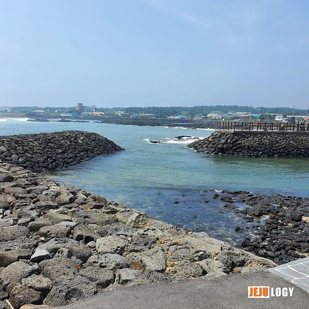
The Real Heart of Onpyeong: Its Coast
But what makes Onpyeong feel like Onpyeong is the sea. The shoreline runs about six kilometers, and for generations it has been the working stage and memory bank of the village community. At the center of that stretch sits Onpyeong-dong Port, known in the village simply as Dongpogu — “the East Port.” Like the Jeju words uddeureu and aldeureu (upper field, lower field), the name reflects how locals navigate by lived geography rather than maps; it is a small reminder that place names here carry orientation as well as identity.
This port is more than a fishing harbor. It is a junction where livelihood, memory, and community quietly converge.
![[2] A jeongja (pavilion) marks the entrance to the port, where villagers gather and rest. — webp_20200804_112340.webp](https://storage.ghost.io/c/27/82/2782049d-b330-4d63-9244-d8b910f54396/content/images/2026/05/webp_20200804_112340.webp)
A Working Harbor — and a Haenyeo Harbor
Historically, this was the haenyeo's main point of departure. Before dawn, dozens of women divers would walk out through the port carrying their gear; in the evening they returned through the same entrance. Seaweed, top shells, brown algae (tot), and octopus all moved through here on their way to land markets, and the cash from the catch became a backbone of household income.
A portion of the catch, remarkably, was donated to the village school as a fund. The villagers called the relevant fishing ground their hakgyo badang — the “School Sea” — together sustaining the educational base of the community through what the sea provided. The port, in other words, was never a purely economic site. The sea here was a social asset that supported village life as a whole.
![[3] A wooden walkway leads out across the harbor toward the breakwater. — webp_20200804_112357.webp](https://storage.ghost.io/c/27/82/2782049d-b330-4d63-9244-d8b910f54396/content/images/2026/05/webp_20200804_112357.webp)
Around the port are several springs — vital infrastructure in a village where water was always scarce. Names like Hwenjuk Mooltong, Doneun Mool, and Aegijukneunnal Mool are not just labels for water sources; they are names tied to local stories and shared history. Some springs were reserved for household use, others for livestock, and residents distinguished those uses precisely.
Near the port there are also natural lava-tube caves such as Seogung-gwegul and Monang-gwegul, which were used as hiding places by villagers during the Jeju 4·3 Incident, and later as storage. Most are now sealed off, so I couldn't verify them firsthand, but they remain vivid in the memories of the older residents — at least according to a 2016 oral history of the Jeju dialect published by Jeju Special Self-Governing Province.
![[4] A traditional Jeju teu raft sits on the calm water inside the port — a quiet nod to how people once worked these shores. — webp_20200804_112449.webp](https://storage.ghost.io/c/27/82/2782049d-b330-4d63-9244-d8b910f54396/content/images/2026/05/webp_20200804_112449.webp)
Sea as a Negotiated Space: the Gaegeum
Onpyeong's fishing community managed the sea by parceling it into zones called gaegeum. Specific stretches of water were assigned and adjusted through community agreement, and even the maritime boundaries with neighboring Sinyang-ri and Sinsan-ri were settled through this concept. In other words, the coastline wasn't a simple physical edge — it was a social space where rules, cooperation, and occasional conflict were all woven together.
![[5] Volcanic basalt and shallow tide pools — the same rough coast that the haenyeo have worked for generations. — webp_20200804_112618.webp](https://storage.ghost.io/c/27/82/2782049d-b330-4d63-9244-d8b910f54396/content/images/2026/05/webp_20200804_112618.webp)
The Arched Passage and Its Ribbons
Out on the breakwater there is an arched passageway. Someone once described it to me as a yeolsoe-tongno — a “key passage.” When I took these photos, though, the arch had ribbons tied across it like a small village shrine.
I imagine they were left there as quiet wishes — for the safety of those heading out to sea.
![[6] Ribbons tied to the arched passage out on the breakwater — small, hopeful gestures toward the sea. — webp_20200804_112512.webp](https://storage.ghost.io/c/27/82/2782049d-b330-4d63-9244-d8b910f54396/content/images/2026/05/webp_20200804_112512.webp)
When the wave turns, the moon above the sea trembles; when the moon rises, the waves below begin to dance.
The Statues at the End of the Walkway
There are stone figures placed along the path, and I couldn't find any signage explaining them. But given that this is Onpyeong-ri, my guess is that they represent the three deities of the Tamna founding myth and the three princesses of Byeoknang-guk who arrived here in a wooden chest. The old village name Yeoun-i (열운이), after all, is said to mean “the place that was opened, the place where bonds were tied — the place of marriage.”
![[7] Stone figures stand quietly along the walkway — likely a nod to the founding myth that gives this village its meaning. — webp_20200804_112627.webp](https://storage.ghost.io/c/27/82/2782049d-b330-4d63-9244-d8b910f54396/content/images/2026/05/webp_20200804_112801.webp)
Hwanhae-jangseong: Tamna's “Great Wall”
Along the Onpyeong coast runs a long stone rampart known as Hwanhae-jangseong. Originally built in the Goryeo period to defend against foreign raiders, it was extended through the Joseon era into a coastal defense line stretching roughly 2.1 kilometers in this area.
In Jeju, it is sometimes called the “Great Wall of Tamna” in recognition of its scale and historical weight. In recent years, however, coastal road construction and tourism development have put parts of the original wall at risk of being lost, and there is real local concern about the need for proper preservation and restoration.
![[8] A bench and a small cluster of stone cairns near the port — a place that invites you to sit and slow down. — webp_20200804_113342.webp](https://storage.ghost.io/c/27/82/2782049d-b330-4d63-9244-d8b910f54396/content/images/2026/05/webp_20200804_113342.webp)
A Place Still Being Written
Onpyeong-ri and its port hold the roots and identity of Jeju in a remarkably concentrated way. But the people living here are not confined to the past. Depending on what happens with the proposed Jeju Second Airport, another chapter — for better or for worse — may yet be added to this village's record. Onpyeong-ri is, very much, a place still being written.
![[9] A stone-walled tide pool by the port — once a practical fixture of village life, now a quiet pocket on the shore. — webp_20200804_113356.webp](https://storage.ghost.io/c/27/82/2782049d-b330-4d63-9244-d8b910f54396/content/images/2026/05/webp_20200804_113356.webp)
Location: Onpyeong-ri, Seongsan-eup, Seogwipo-si, Jeju Special Self-Governing Province, South Korea. All photographs were taken on-site at Onpyeong-dong Port.